|
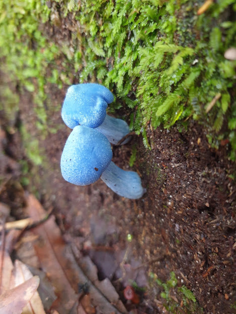
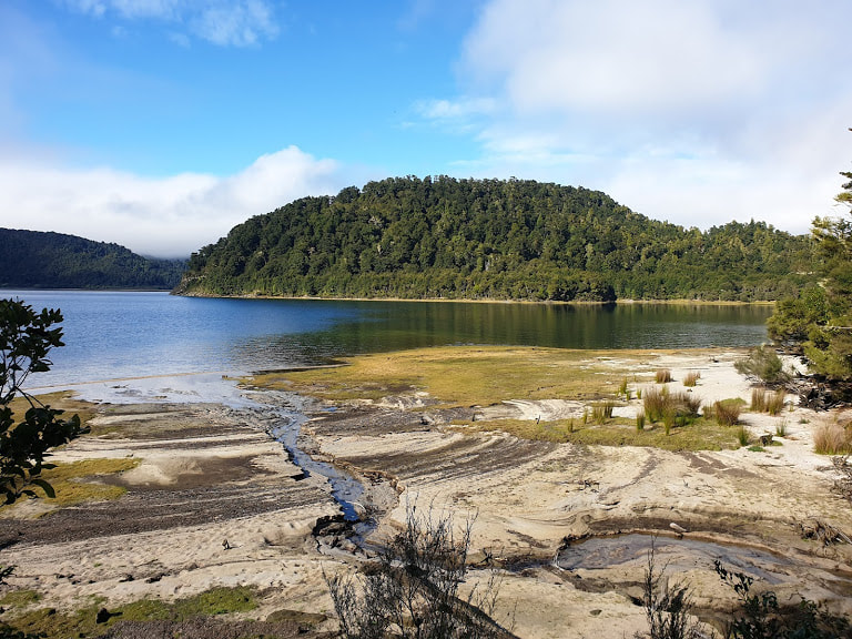
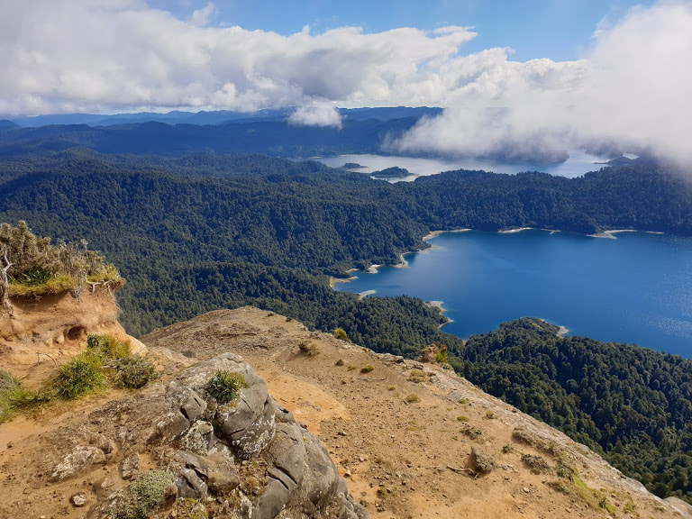
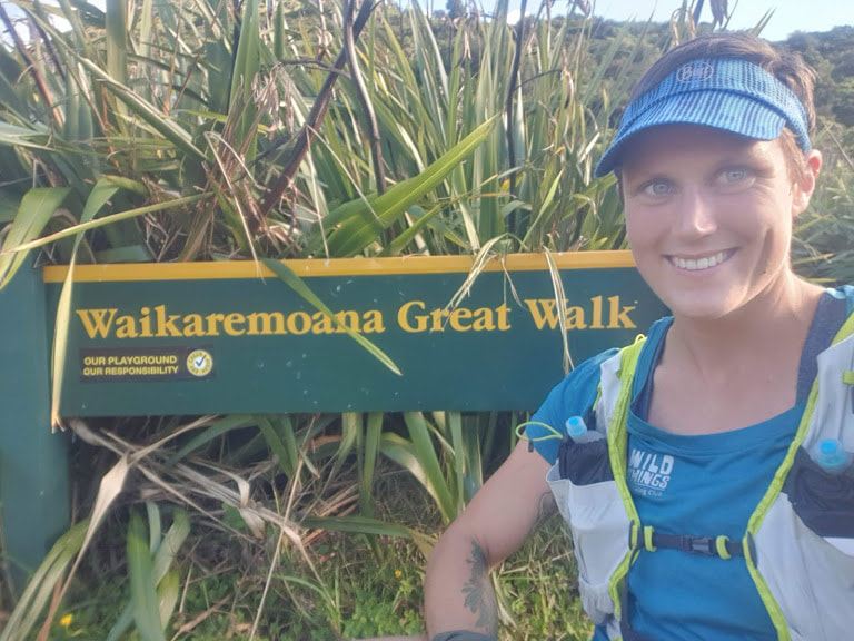
With the Routeburn and Rakiura under my belt, I set off for the North Island to tackle my next challenges. Having picked up a rental van in Wellington, I left Wairoa at dinner time and began the slow and winding drive to Lake Waikaremoana. By the time I pulled into the holiday park, it was dark and raining. I gratefully submitted to an early night, curled up in the back of the van. The next morning I awoke to continued rain. I made coffee and headed over to te Kura Whenua, the beautiful new visitors' centre built by Nga Tuhoe, the caretakers of Te Urewera. Since 2014, a Treaty Settlement between Tuhoe and the Crown endowed Te Urewera with the legal power of its own entity: Te Urewera cannot be owned by anyone. Tuhoe were named custodians of Te Urewera and have since stepped into the roles formerly filled by Department of Conservation staff, such as hut wardening and pest control in the area. Their visitors' centre has a tiny gift shop where you can buy items emblazened with the phrase 'care for nature,' but it is otherwise sparse. Two display cabinets sit empty, awaiting strengthening before receiving Tuhoe taonga, or treasured artifacts. I chatted with Tina, who was taking care of the water taxi bookings, and seemingly most of the daily running of this part of Te Urewera, about postponing my booking by a day in hope of better weather. She enthusiastically agreed to this plan, and I happily went back to bed with a book. 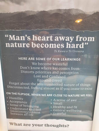 The holiday park was quiet. There was a young couple sharing a tiny tent and an equally tiny Toyota Platz. They sat out the rain side by side in its front seats, reading. Groups of hunters pore over maps at the visitors' centre, and all of the fishermens cabins do indeed appear to be filled with fishermen, largely of the silver-haired variety. I find a wonderful book on the Tuhoe people in the visitors' centre, and I sit reading it for over an hour. Eventually Tina sits down for a korero. She talks of Tuhoe's desire to honestly assess every action in terms of its effects on Te Urewera, with a 'no harm' goal. We discuss a section of the track which was closed for several months this summer, due to structural concerns about a bridge. From the outside it has appeared that the closure dragged on for much longer than necessary, and I had wondered if this was due to inefficiencies as Nga Tuhoe and the Department of Conservation work together on managing the Waikaremoana track. I learned that there was much more to it; the approach that Tuhoe seek to take is a truly holistic one where every impact is considered, no matter the time taken. When looking at using helicopters, they consider the contribution to climate change and ask if it is truly necessary. They seek to reduce waste and to use non-tanninised timber, to reduce the impact on Te Urewera. This thoroughness of course slows decision making processes, yet I find it inspirational. Speaking with Tina, the vibe I got was idealistic and optimistic. I love that this is the spirit in which Te Urewera is being managed. I went for a short run in the afternoon to loosen up the body and take in a couple of local waterfalls, and went to bed that night feeling happy and excited. 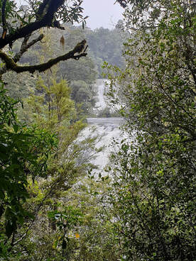 The following day the mountains were still hiding in cloud, but the temperature was noticeably warmer as we boarded the water taxi. The water level was too low to access Hopuruahine Landing by boat, so we were dropped at Whanganui hut to start. I felt heavy and slow from the outset, slowly settling into my rhythm as I neared the edge of the kiwi enclosure. The track went up and over a small hill before continuing along the lakeshore once more. I began to appreciate the short uphill sections interspersed with lovely downhill running, my body slowly relaxing into it, relief coursing through me. I could do this. I spotted a couple of bright blue Hochstetter mushrooms on the side of the trail, which always make me smile. The forest was gorgeous, with big Mamaku ferns stretching their dark fronds sensuously over the track. The cloud was slowly burning off, gifting me views of the perfectly still and calm lake as I continued around. The track kept me on my toes with sections of slippery rock and tricky tree roots, but continued to be gently undulating. 23 kilometres in I reached Waiopaoa hut. The last pit stop before attacking the Panekire Range. Apprehensive but tracking well for time, I gobbled down some food and reminded myself that it was ok to walk the steep sections. I set off, gradually ascending through glorious tawa forest. Then things got seriously steep, with several sections of stairs. Once the track rejoined the ridge I was soon immersed in a mossy wonderland. In the clouds, the forest told me that was its usual state, everything laden with moisture, lush and dripping. Green upon green, times infinity. I reached Panekire hut before I knew it. I eagerly anticipated some downhill running. The last stretch of ridge blessed me with some incredible views as the clouds parted perfectly. The descent to Onepoto was much steeper than I'd realised, making running it a real struggle. My knees loudly voiced their unhappiness as I stumbled down. Eventually I was at the road, exhausted, more relieved than anything, but as I checked my time, a smile slowly spread across my face.... yessss. I stopped back at the Visitor's Centre and waved through the window to Tina, who came running out with a big smile. She was thrilled to know that I had finished, and in half decent time. “You could be one of those multisporters!” she told me. I laughed self consciously and thanked her for all her help. Although this trail had been one of the more logistically tricky ones I had run so far, the hidden gift it had brought me was the interaction with local people such as Tina, which gave a beautiful human element to the adventure. Waikaremoana will stay in my memories for a long time to come.
0 Comments
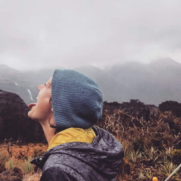
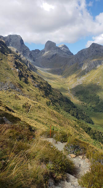 Emily Peak, as seen from the Routeburn Track Emily Peak, as seen from the Routeburn Track In the final days of 2018, I had spent eight days traversing some of the most spectacular terrain of my life. The three people I was with each had a unique approach to life, a level of commitment to adventure and challenge, that really moved me. I was working a lot this past summer, and had little time for these trips, yet this one left me hungering after... something? I felt a deep desire to set myself a goal, one that would truly test me. I pondered objectives. Climbing, mountaineering, or running? With small windows of time off, I thought running would be my best bet. I have always said of the Great Walks, that I would love to run them all someday. Right, 2019 would be that someday. Having never run farther than a marathon, this was a goal that would push me, but that I thought I could achieve. I knew the key to following through was to tell people about my goal, and then to take a first step. So, after seeing the New Year in near Wanaka, I set out on the first of January to run the Routeburn Track. The day dawned clear, my tummy full of bubbles of excitement. Starting near Paradise, the track weaved gradually up valley, making for lovely running. I passed smiling faces, everyone calling, “Happy New Year!” as I passed. This pleasant cruise continued all the way to Routeburn Falls hut, where the track left the beech forest, and an alpine wonderland unfolded. A tussock basin dotted with mountain daises and gentians, presided over by an increasingly moody sky. I stopped to put a warm top on, before continuing on in search of Lake Harris. When I popped up at lake level, rocky bluffs all around, I gave a woop of joy. It was so stunning. I passed a busy Harris Shelter, stoked for some flowy downhill running on the Fiordland side. My views were mostly shrouded in cloud, but I knew this landscape well enough to fill in the gaps. Somewhere between Harris Saddle and the descent to Lake Mackenzie, I came across the Te anau runners who I was to swap keys with, to get our cars back around to our respective sides. We snapped a selfie, all smiles, and it was neat to share a moment with other runners. As the track descended to Lake Mackenzie, I enjoyed the views and the magical goblin forest I was entering. I took a quick stop at the hut, and had a yarn with the hut warden, Evan, who raised funds for the large number of stoat traps in the area. A bloody legend. The work has paid off, and I appreciated the number of riflemen squeaking in the bush as I passed through. As the track climbed on, the rain really set in. I passed a group of trampers who couldn't believe I was going all the way to the Divide - “that's really far!” Hmm. Not quite the encouragement my tired legs needed. But hey, I asked for a challenge. Puddles under foot, rain dripping off my nose, plod plod plod. There, the turn off to Key Summit. A wave of relief and happiness. Smooth running ahead, with long switchbacks descending to the finish. I'd done it. 32Km 'off the couch'. It hadn't been easy, but it had been a great start to my challenge. Two months later, the Rakiura Track was in my sights. I collected my friends from the Invercargill airport and we set off to catch the ferry from Bluff, conversation bouncing between catching up on each others' lives and quizzing one another on the run ahead – Do you think I have enough food? Did you bring Gurney goo? Are you gonna run in shorts? Being so used to running alone, and having noone to ask these things of, I couldn't stop grinning. These were my people! We scored a pretty calm crossing of Foveaux Straight (despite the coffee stains on my shirt suggesting otherwise!), and stepped off the boat in Oban to find a cool and partly cloudy day. Perfect. We had not long checked in at the backpackers and our lift to the trailhead arrived. No time to get nervous, we were into it. Our local guide told us his daughters had also run the track, and snapped a group shot of us before wishing us luck and leaving us to it. There was a long pause before one of us asked, “I guess we start running now?” Nervous giggles and we were off. The first six kilometres of track had me feeling like I was on the Abel Tasman. Long golden sand beaches and tourqoise water that looked deliciously inviting as we warmed up. The track wound through a forest of tree ferns and kamahi, draped with tangles of supplejack – the kind of bush in which one is grateful for a cut track. After Maori Beach the track climbs up before giving us the choice of an out-and-back trip to Port William hut. We chose not to, based on the mistaken belief that this would add 4km to the stated 32km length of the track (it is in fact included in the 32km total). The ten kilometre stretch from this junction to North Arm hut was absolutely my favourite part of this run, getting progressively more muddy. Beautiful big Rimu trees towered overhead as I sloshed my way through the slop, giggling with glee. Having seperated from my mates, a 'halfway buoy' hanging from a tree overhead gave me a boost of encouragement as I plowed on. Nearing North Arm hut the forest changed to stands of Manuka, with mounting anticipation of reaching the coast again. From the hut, the track followed the coastline past several lovely bays. At Sandfly Bay I admired several big gorgeous rata trees, bent and gnarled. Tui twirled and chortled overhead, and I remembered startling a deer in this section when I ran this track three years ago. I eventually reached an old logging 'road', the trail became wider, and I knew I was on the home stretch. I stepped up the pace and reached the carpark feeling pretty wrecked, but stoked. I had a good sit down before starting the walk back to the backpackers. A couple of hours later we were at the pub demolishing burgers, and that beer never tasted so good. Two down, seven to go. The adventure was only just beginning. 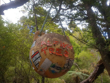 |
I am a conservation field worker in New Zealand. I love mountains, sunrises, river swims, barefeet, cold beer, campfires, live music and whiskey.
Archives
April 2020
Categories
All
|
 RSS Feed
